Approximate Location Map
Large Map »
Latitude: 56.1916 / 56°11'29"N
Longitude: -2.822 / 2°49'19"W
OS Eastings: 349082
OS Northings: 700185
OS Grid: NO490001
Mapcode National: GBR 2Q.FV8F
Mapcode Global: WH7SR.MMCV
Plus Code: 9C8V55RH+J5
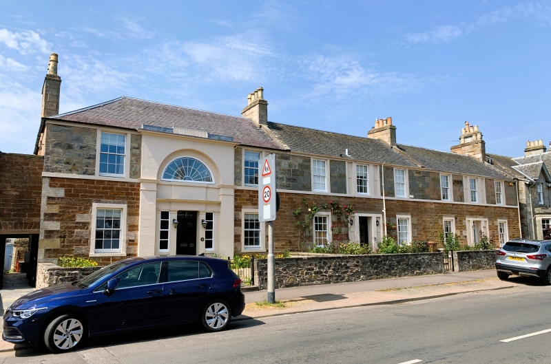
Entry Name: 33 Park Place, Elie
Listing Name: Elie 33-37 Park Place
Listing Date: 18 August 1972
Category: B
Source: Historic Scotland
Source ID: 372172
Historic Scotland Designation Reference: LB30988
Building Class: Cultural
Also known as: Elie, 33 Park Place
ID on this website: 200372172
Location: Elie and Earlsferry
County: Fife
Town: Elie And Earlsferry
Electoral Ward: East Neuk and Landward
Traditional County: Fife
Tagged with: House
Early 19th century, perhaps 2 building periods. 2-storey, red coursed rubble with droved dressings ground floor, droved white ashlar 1st floor; 3 houses, 35 and 37 3-window, centre tripartites with blind side lights: 33 is 2-window with large arched and pilastered central entrance bay with tripartite pilastered doorpiece ground floor and fanlight window 1st floor; slated.
External links are from the relevant listing authority and, where applicable, Wikidata. Wikidata IDs may be related buildings as well as this specific building. If you want to add or update a link, you will need to do so by editing the Wikidata entry.


Other nearby listed buildings
