Approximate Location Map
Large Map »
Latitude: 56.19 / 56°11'23"N
Longitude: -2.8197 / 2°49'10"W
OS Eastings: 349228
OS Northings: 700010
OS Grid: NO492000
Mapcode National: GBR 2Q.FVXB
Mapcode Global: WH7SR.NPJ1
Plus Code: 9C8V55QJ+X4
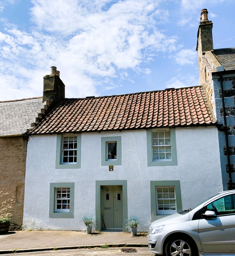
Entry Name: 9 Rankeillor Street, Elie
Listing Name: 9 Rankeillor Street
Listing Date: 18 August 1972
Category: B
Source: Historic Scotland
Source ID: 372189
Historic Scotland Designation Reference: LB31003
Building Class: Cultural
Also known as: Elie, 9 Rankeillor Street
ID on this website: 200372189
Location: Elie and Earlsferry
County: Fife
Town: Elie And Earlsferry
Electoral Ward: East Neuk and Landward
Traditional County: Fife
Tagged with: Architectural structure
18th century, 2-storey white harl with painted margins, pantiled and crowstepped. Restored.
External links are from the relevant listing authority and, where applicable, Wikidata. Wikidata IDs may be related buildings as well as this specific building. If you want to add or update a link, you will need to do so by editing the Wikidata entry.


Other nearby listed buildings
