Approximate Location Map
Large Map »
Latitude: 56.1894 / 56°11'21"N
Longitude: -2.8337 / 2°50'1"W
OS Eastings: 348354
OS Northings: 699958
OS Grid: NT483999
Mapcode National: GBR 2P.G5B1
Mapcode Global: WH7SR.FPVG
Plus Code: 9C8V55Q8+QG
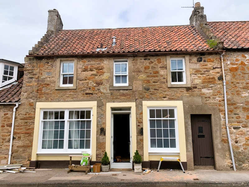
Entry Name: The Riggings, 4 High Street, Earlsferry
Listing Name: Earlsferry, 4 High Street, the Riggings
Listing Date: 18 August 1972
Category: C
Source: Historic Scotland
Source ID: 372261
Historic Scotland Designation Reference: LB31069
Building Class: Cultural
ID on this website: 200372261
Location: Elie and Earlsferry
County: Fife
Town: Elie And Earlsferry
Electoral Ward: East Neuk and Landward
Traditional County: Fife
Tagged with: House
18th century. Two 2-storey houses, 6-window; rubble with
painted margins, pantiled with crowsteps, ground floor.
Shops, eastern part restored, 3 windows inserted to match
3 at 1st floor.
External links are from the relevant listing authority and, where applicable, Wikidata. Wikidata IDs may be related buildings as well as this specific building. If you want to add or update a link, you will need to do so by editing the Wikidata entry.


Other nearby listed buildings
