Latitude: 55.9999 / 55°59'59"N
Longitude: -3.7862 / 3°47'10"W
OS Eastings: 288700
OS Northings: 679989
OS Grid: NS887799
Mapcode National: GBR 1K.TTMB
Mapcode Global: WH5QZ.TG78
Plus Code: 9C7RX6X7+XG
Entry Name: Churchyard Gate, Falkirk Old Parish Church, High Street, Falkirk
Listing Name: Falkirk Parish Churchyard Gate
Listing Date: 21 March 1960
Category: B
Source: Historic Scotland
Source ID: 372377
Historic Scotland Designation Reference: LB31169
Building Class: Cultural
Also known as: Falkirk, High Street, Falkirk Old Parish Church, Churchyard Gate
ID on this website: 200372377
Location: Falkirk
County: Falkirk
Town: Falkirk
Electoral Ward: Falkirk South
Traditional County: Stirlingshire
Tagged with: Gate Architectural structure
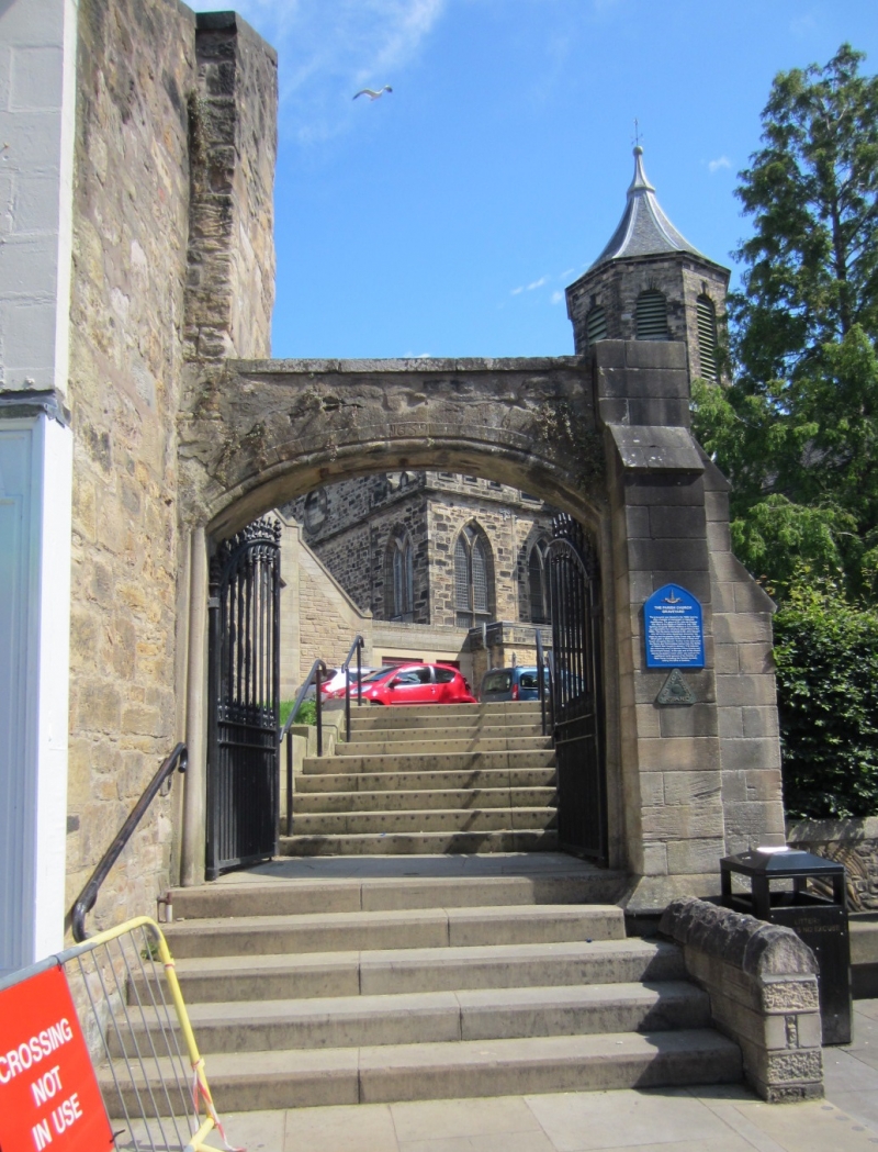
Dated 1659. Moulded segmental arch. Buttress on east side
recent. 19th century cast iron gothic gates.
External links are from the relevant listing authority and, where applicable, Wikidata. Wikidata IDs may be related buildings as well as this specific building. If you want to add or update a link, you will need to do so by editing the Wikidata entry.


Other nearby listed buildings