Latitude: 55.9992 / 55°59'57"N
Longitude: -3.7834 / 3°47'0"W
OS Eastings: 288875
OS Northings: 679912
OS Grid: NS888799
Mapcode National: GBR 1K.V206
Mapcode Global: WH5QZ.VGLR
Plus Code: 9C7RX6X8+MM
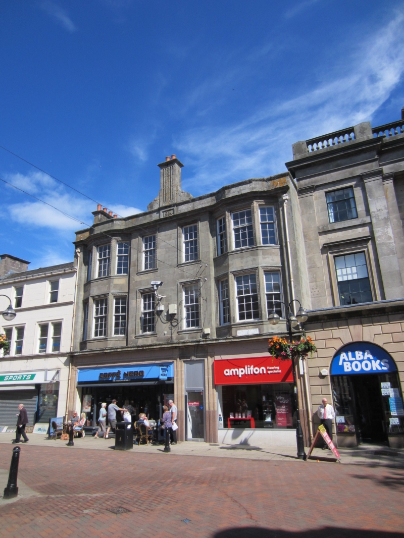
Entry Name: 136 High Street, Falkirk
Listing Name: 132-136A High Street
Listing Date: 25 October 1972
Category: C
Source: Historic Scotland
Source ID: 372392
Historic Scotland Designation Reference: LB31182
Building Class: Cultural
ID on this website: 200372392
Location: Falkirk
County: Falkirk
Town: Falkirk
Electoral Ward: Falkirk South
Traditional County: Stirlingshire
Tagged with: Architectural structure
Dated 1914. Renaissance. 3-storey ashlar, 2-window centre
flanked by shallow bay windows, finely moulded architraves,
central fluted wallhead chimney, ground floor shop.
Re-categorised as C(S) from B for Group. The listing relates specifically to the group intetest of the subject. It applies, as always, to interior as well as exterior, as appropriate to building type.
External links are from the relevant listing authority and, where applicable, Wikidata. Wikidata IDs may be related buildings as well as this specific building. If you want to add or update a link, you will need to do so by editing the Wikidata entry.


Other nearby listed buildings