Latitude: 56.2529 / 56°15'10"N
Longitude: -3.2097 / 3°12'34"W
OS Eastings: 325144
OS Northings: 707364
OS Grid: NO251073
Mapcode National: GBR 27.B4VG
Mapcode Global: WH6R7.N3R9
Plus Code: 9C8R7Q3R+44
Entry Name: House (National Trust), High Street West, Falkland
Listing Name: House (National Trust, Empty in 1971), High Street West
Listing Date: 1 December 1971
Category: B
Source: Historic Scotland
Source ID: 372490
Historic Scotland Designation Reference: LB31264
Building Class: Cultural
Also known as: Falkland, High Street West, House (national Trust)
ID on this website: 200372490
Location: Falkland
County: Fife
Town: Falkland
Electoral Ward: Howe of Fife and Tay Coast
Traditional County: Fife
Tagged with: House
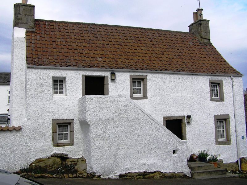
Dated IEMG 1751 at lintel 2-storey rubble-built with margins, forestairs; Roman tiled in 1971. Built on natural rock
foundation.
Restoration work about to be put in hand.
External links are from the relevant listing authority and, where applicable, Wikidata. Wikidata IDs may be related buildings as well as this specific building. If you want to add or update a link, you will need to do so by editing the Wikidata entry.


Other nearby listed buildings