Approximate Location Map
Large Map »
Latitude: 56.6446 / 56°38'40"N
Longitude: -2.8874 / 2°53'14"W
OS Eastings: 345677
OS Northings: 750656
OS Grid: NO456506
Mapcode National: GBR VM.4K90
Mapcode Global: WH7QL.M881
Plus Code: 9C8VJ4V7+R2
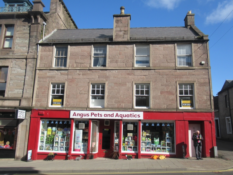
Entry Name: 17 And 19 East High Street, Forfar
Listing Name: 17, 19 East High Street
Listing Date: 11 June 1971
Category: B
Source: Historic Scotland
Source ID: 372741
Historic Scotland Designation Reference: LB31482
Building Class: Cultural
Also known as: Forfar, 17 And 19 East High Street
ID on this website: 200372741
Location: Forfar
County: Angus
Town: Forfar
Electoral Ward: Forfar and District
Traditional County: Angus
Tagged with: Architectural structure
Early 19th century. 3-storey 4-window ashlar, cill course 1st
and 2nd floor, centre chimney; ground floor shop mainly
original with lintel course. Slated.
External links are from the relevant listing authority and, where applicable, Wikidata. Wikidata IDs may be related buildings as well as this specific building. If you want to add or update a link, you will need to do so by editing the Wikidata entry.


Other nearby listed buildings
