Approximate Location Map
Large Map »
Latitude: 56.6441 / 56°38'38"N
Longitude: -2.8893 / 2°53'21"W
OS Eastings: 345562
OS Northings: 750611
OS Grid: NO455506
Mapcode National: GBR VM.4JTM
Mapcode Global: WH7QL.L8CC
Plus Code: 9C8VJ4V6+M7
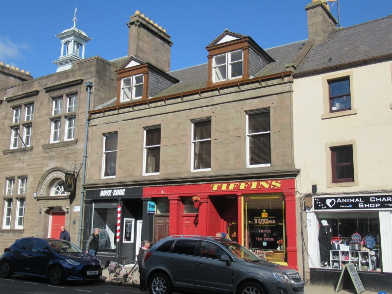
Entry Name: 12 West High Street, Forfar
Listing Name: 12-16 West High Street
Listing Date: 11 June 1971
Category: C
Source: Historic Scotland
Source ID: 372769
Historic Scotland Designation Reference: LB31502
Building Class: Cultural
ID on this website: 200372769
Location: Forfar
County: Angus
Town: Forfar
Electoral Ward: Forfar and District
Traditional County: Angus
Tagged with: Architectural structure
Mid Victorian. 2-storey and attic 4-window, original
pilastered and cast-iron columned ground floor shops, 1st
floor snecked rubble with fanciful piended surrounds, 2
pedimented dormers.
Re-categorised as C(S) from B for Group (2006). The listing relates specifically to the group interest of the subject. It applies, as always, to interior as well as exterior, as appropriate to building type.
External links are from the relevant listing authority and, where applicable, Wikidata. Wikidata IDs may be related buildings as well as this specific building. If you want to add or update a link, you will need to do so by editing the Wikidata entry.


Other nearby listed buildings
