Approximate Location Map
Large Map »
Latitude: 57.61 / 57°36'36"N
Longitude: -3.6134 / 3°36'48"W
OS Eastings: 303702
OS Northings: 858928
OS Grid: NJ037589
Mapcode National: GBR K8FM.5JH
Mapcode Global: WH5H4.GZLG
Plus Code: 9C9RJ96P+2M
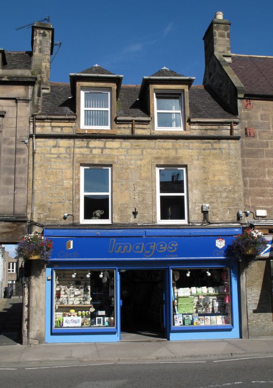
Entry Name: 89 High Street, Forres
Listing Name: 89 High Street
Listing Date: 30 March 1983
Category: C
Source: Historic Scotland
Source ID: 372946
Historic Scotland Designation Reference: LB31651
Building Class: Cultural
ID on this website: 200372946
Earlier 19th century. 2 storeys and attic, 2 bays; much
altered. Coursed rubble with tooled ashlar margins. Modern
shopfront at ground floor; wallhead raised, c.1900, with 2
piended wallhead dormers; 2- and 4-pane glazing. Slated roof.
Group value.
Former Item 35 (1983 Revised List)
External links are from the relevant listing authority and, where applicable, Wikidata. Wikidata IDs may be related buildings as well as this specific building. If you want to add or update a link, you will need to do so by editing the Wikidata entry.


Other nearby listed buildings
