Latitude: 57.6108 / 57°36'38"N
Longitude: -3.6114 / 3°36'41"W
OS Eastings: 303819
OS Northings: 859008
OS Grid: NJ038590
Mapcode National: GBR K8GL.SH4
Mapcode Global: WH5H4.HYHW
Plus Code: 9C9RJ96Q+8C
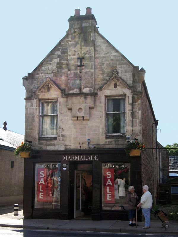
Entry Name: 44 High Street, Forres
Listing Name: 44 High Street
Listing Date: 30 March 1983
Category: C
Source: Historic Scotland
Source ID: 372978
Historic Scotland Designation Reference: LB31679
Building Class: Cultural
ID on this website: 200372978
Later 19th century rebuild of early 19th century house. Gable
end to street 2-storey and attic, 3-bay with 3-bay shop front
to High Street. Rendered and lined as ashlar; tooled ashlar
dressings; decorative string course; 2 canted dormers; 2-
and 4-pane glazing. Coped end stacks; slate roof.
Corner site with Urquhart Street. Original roof appears to
have been heightened.
Former Item 63 (1983 Revised List)
External links are from the relevant listing authority and, where applicable, Wikidata. Wikidata IDs may be related buildings as well as this specific building. If you want to add or update a link, you will need to do so by editing the Wikidata entry.


Other nearby listed buildings