Latitude: 57.5783 / 57°34'41"N
Longitude: -4.1339 / 4°8'2"W
OS Eastings: 272493
OS Northings: 856258
OS Grid: NH724562
Mapcode National: GBR J85P.M3C
Mapcode Global: WH4FY.GSP7
Plus Code: 9C9QHVH8+8C
Entry Name: Harbour, The Shore, Fortrose
Listing Name: Fortrose the Shore the Harbour
Listing Date: 31 August 1983
Category: B
Source: Historic Scotland
Source ID: 373177
Historic Scotland Designation Reference: LB31835
Building Class: Cultural
Also known as: Fortrose, The Shore, Harbour
ID on this website: 200373177
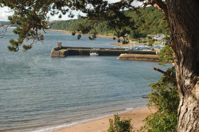
Thomas Telford, 1813-17. Small rectangular basin enclosed by
2 piers; east pier rubble; west pier L-plan, coursed rubble.
Repairs, James Fraser, CE, 1881, and later.
James Fraser also built 1881 a 690 long pier, now demolished.
Beside harbour is warehouse of 18<> (now sailing club) which
has been much altered.
External links are from the relevant listing authority and, where applicable, Wikidata. Wikidata IDs may be related buildings as well as this specific building. If you want to add or update a link, you will need to do so by editing the Wikidata entry.


Other nearby listed buildings