Latitude: 57.5913 / 57°35'28"N
Longitude: -4.1149 / 4°6'53"W
OS Eastings: 273675
OS Northings: 857666
OS Grid: NH736576
Mapcode National: GBR J86N.HV2
Mapcode Global: WH4FY.RGQ9
Plus Code: 9C9QHVRP+G2
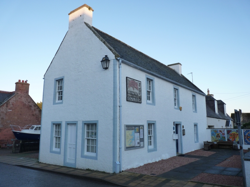
Entry Name: Groam House, 36 High Street, Rosemarkie
Listing Name: Rosemarkie High Street Groam House
Listing Date: 31 August 1983
Category: B
Source: Historic Scotland
Source ID: 373193
Historic Scotland Designation Reference: LB31848
Building Class: Cultural
Also known as: Rosemarkie, 36 High Street, Groam House
ID on this website: 200373193
Location: Fortrose
County: Highland
Town: Fortrose
Electoral Ward: Black Isle
Traditional County: Ross-shire
Tagged with: Building
Late 18th/early 19th century, gable to street. 2 storeys, 3-bay
front with centre door. In gable to street, door flanked by
windows at ground floor and window at left at first floor.
Harled with painted margins. 12-pane sashes. Slate roof.
Restored after fire circa 1978.
External links are from the relevant listing authority and, where applicable, Wikidata. Wikidata IDs may be related buildings as well as this specific building. If you want to add or update a link, you will need to do so by editing the Wikidata entry.


Other nearby listed buildings