Latitude: 55.8666 / 55°51'59"N
Longitude: -4.2848 / 4°17'5"W
OS Eastings: 257117
OS Northings: 666069
OS Grid: NS571660
Mapcode National: GBR 0DJ.HR
Mapcode Global: WH3P2.4TW0
Plus Code: 9C7QVP88+J3
Entry Name: Kelvingrove Parish Church, 20-30 Bentinck Street, Glasgow
Listing Name: 49 Derby Street, 22, 30 Bentinck Street
Listing Date: 6 July 1966
Category: A
Source: Historic Scotland
Source ID: 376346
Historic Scotland Designation Reference: LB33015
Building Class: Cultural
Also known as: 20-30 Bentinck Street, Kelvingrove Parish Church
Former Kelvingrove Church of Scotland, Kelvingrove
ID on this website: 200376346
Location: Glasgow
County: Glasgow
Town: Glasgow
Electoral Ward: Anderston/City/Yorkhill
Traditional County: Lanarkshire
Tagged with: Church building
James Sellars (Campbell Douglas and Sellars), 1879-80.
Greek Revival church. Rectangular plan on corner site
with temple-front to Derby Street. 6 x 9 bays. Polished
ashlar, banded at ground floor; squared rubble rear and
side elevation. Ground floor cornice. Eaves frieze,
cornice and parapet raised at angles. Slate roof. All
windows casement in architraves with glazing bars.
ELEVATION TO DERBY STREET: full-height tetrastyle Greek
Ionic, portico at head of stone steps with responds;
plain entablature with pediment and acroterion. Single
doorway on back wall with carved frieze and cornice;
frieze above doorway. Attenuated octagonal roof lantern
with semi-engaged Corinthian columns and entablature
supported on square plinth with angle crowning dome.
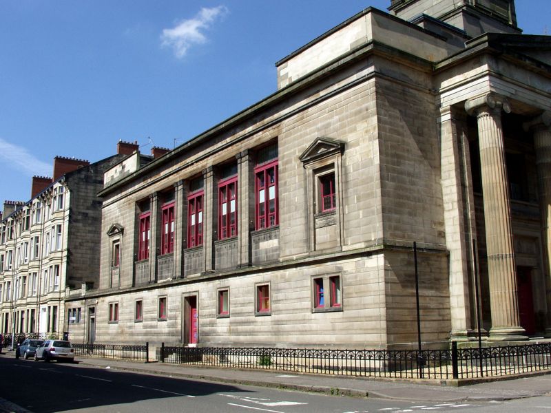
ELEVATION TO BENTINCK STREET: 2 storeys, 8 full bays and
2 further bays of a low office wing continuing ground
floor window pattern with 3-light Doric pilaster mullioned
window to left of entrance at No 30. 8 bays arranged
1-5-1; ground floor 2 architraved, recessed doorways with
fanlights at No 30 and No 22. 6 small windows with fluted
Doric pilaster mullions in outer bays. 1st floor
pilastrade of 5 bays with tripartite mullioned and single-
transomed windows; painted glass in lower panels; moulded
cills; architraves dropped to ground floor cornice;
paterae frieze in aprons. Aediculed outer bays with
sculpted apron frieze.
Rear elevation: elliptically curved with 5 mullioned and
transomed casement windows lighting gallery.
ELEVATION TO PARKGROVE TERRACE LANE: plain, repeating
Bentinck Street window arrangement.
Interior: Vestibule corniced piers; flat coffered ceiling
with frieze; left and right stone staircase with cast-
iron balusters and carved timber newel posts. Carved
memorials facing main entry.
Elliptical Ionic screen in gallery. Carved gallery front
with frieze.
Carved semi-circular pulpit with aedicule behind.
Tetrastyle elliptical column screen in basement hall.
Basement lit by cast-iron grilles in floor of main church.
Roof lantern free interpretation of Choragic Monument of
Lysicrates. Built as Finnieston Church, now 'CA VA' recording
studios formerly Kelvingrove Parish Church (C of S).
Information from Glasgow City Council (2009) notes that this building has been converted to 18 flats.
External links are from the relevant listing authority and, where applicable, Wikidata. Wikidata IDs may be related buildings as well as this specific building. If you want to add or update a link, you will need to do so by editing the Wikidata entry.


Other nearby listed buildings