Approximate Location Map
Large Map »
Latitude: 57.449 / 57°26'56"N
Longitude: -2.7904 / 2°47'25"W
OS Eastings: 352660
OS Northings: 840128
OS Grid: NJ526401
Mapcode National: GBR M9G1.4F1
Mapcode Global: WH7LS.31HC
Plus Code: 9C9VC6X5+HR
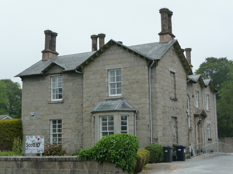
Entry Name: Strathbogie Manse, Deveron Road, Huntly
Listing Name: Strathbogie Manse Deveron Road
Listing Date: 16 April 1971
Category: B
Source: Historic Scotland
Source ID: 379374
Historic Scotland Designation Reference: LB34950
Building Class: Cultural
Also known as: Huntly, Deveron Road, Strathbogie Manse
ID on this website: 200379374
Location: Huntly
County: Aberdeenshire
Town: Huntly
Electoral Ward: Huntly, Strathbogie and Howe of Alford
Traditional County: Aberdeenshire
Tagged with: Manse
1852. Cottage style, large 2-storey asymmetrical with bay
window, broad eaves.
External links are from the relevant listing authority and, where applicable, Wikidata. Wikidata IDs may be related buildings as well as this specific building. If you want to add or update a link, you will need to do so by editing the Wikidata entry.


Other nearby listed buildings
