Approximate Location Map
Large Map »
Latitude: 56.2296 / 56°13'46"N
Longitude: -5.0727 / 5°4'21"W
OS Eastings: 209628
OS Northings: 708368
OS Grid: NN096083
Mapcode National: GBR 00.CDDN
Mapcode Global: WH1JP.1PQ4
Plus Code: 9C8P6WHG+VW
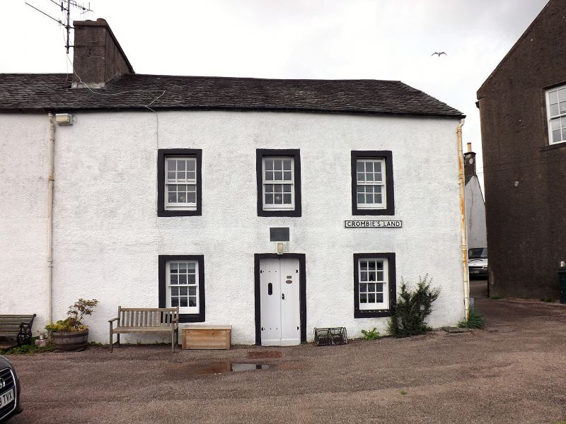
Entry Name: 1 Crombie's Land, Inveraray
Listing Name: Crombie's Land
Listing Date: 4 August 1966
Category: B
Source: Historic Scotland
Source ID: 379470
Historic Scotland Designation Reference: LB35027
Building Class: Cultural
Also known as: Inveraray, 1 Crombie's Land
ID on this website: 200379470
Location: Inveraray
County: Argyll and Bute
Town: Inveraray
Electoral Ward: Mid Argyll
Traditional County: Argyllshire
Tagged with: House
Later 18th century. Plain Georgian. 2 storeys. Harled;
gabled; slate roof.
2 front entrances, 2 outside stairs at rear.
Domestic. 4 main properties. Neil Munro born in house at
N. end in 1864
External links are from the relevant listing authority and, where applicable, Wikidata. Wikidata IDs may be related buildings as well as this specific building. If you want to add or update a link, you will need to do so by editing the Wikidata entry.


Other nearby listed buildings
