Approximate Location Map
Large Map »
Latitude: 57.2789 / 57°16'43"N
Longitude: -2.3711 / 2°22'15"W
OS Eastings: 377724
OS Northings: 820974
OS Grid: NJ777209
Mapcode National: GBR X8.VXCH
Mapcode Global: WH8NW.K94S
Plus Code: 9C9V7JHH+GH
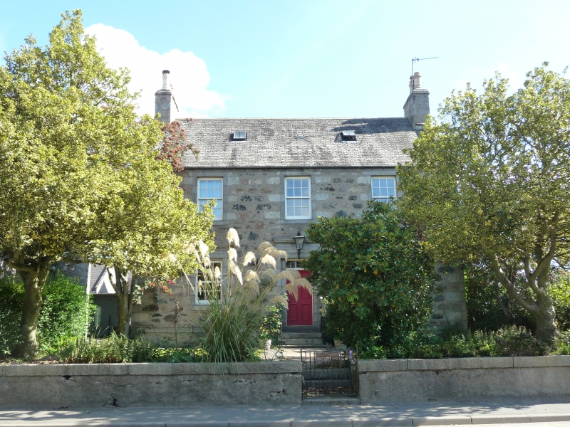
Entry Name: 100 High Street, Inverurie
Listing Name: 100 High Street
Listing Date: 16 April 1971
Category: B
Source: Historic Scotland
Source ID: 379975
Historic Scotland Designation Reference: LB35396
Building Class: Cultural
Also known as: Inverurie, 100 High Street
ID on this website: 200379975
Location: Inverurie
County: Aberdeenshire
Town: Inverurie
Electoral Ward: Inverurie and District
Traditional County: Aberdeenshire
Tagged with: House
Circa 1770. 2-storey 3-window rubble granite with margins,
strip of pulvination at frieze and cornice at doorpiece,
railed steps to door; back wing later or altered later.
External links are from the relevant listing authority and, where applicable, Wikidata. Wikidata IDs may be related buildings as well as this specific building. If you want to add or update a link, you will need to do so by editing the Wikidata entry.


Other nearby listed buildings
