Approximate Location Map
Large Map »
Latitude: 55.5988 / 55°35'55"N
Longitude: -2.4348 / 2°26'5"W
OS Eastings: 372699
OS Northings: 633991
OS Grid: NT726339
Mapcode National: GBR C3FP.NT
Mapcode Global: WH8XZ.KJSR
Plus Code: 9C7VHHX8+G3
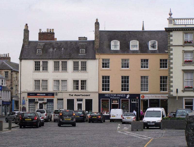
Entry Name: 31, 32 The Square, Kelso
Listing Name: 30, 31, 32 the Square
Listing Date: 16 March 1971
Category: B
Source: Historic Scotland
Source ID: 380506
Historic Scotland Designation Reference: LB35840
Building Class: Cultural
Also known as: Kelso, 31, 32 The Square
ID on this website: 200380506
Location: Kelso
County: Scottish Borders
Town: Kelso
Electoral Ward: Kelso and District
Traditional County: Roxburghshire
Tagged with: Tenement
Late 18th century, 3 storey and attic, ground floor
remodelled as shops in later 19th century, centre door to
flats over. Upper floors rendered with painted ashlar window
margins and cill-course at 1st floor, windows grouped in 3
pairs, original 12 pane double-sash glazing, moulded eaves
course, gable to Roxburgh Street rendered and lined as
ashlar, straight skew and brick stacks, slated roof, pair
catslide attic dormers.
External links are from the relevant listing authority and, where applicable, Wikidata. Wikidata IDs may be related buildings as well as this specific building. If you want to add or update a link, you will need to do so by editing the Wikidata entry.


Other nearby listed buildings
