Approximate Location Map
Large Map »
Latitude: 56.2231 / 56°13'23"N
Longitude: -2.6885 / 2°41'18"W
OS Eastings: 357402
OS Northings: 703610
OS Grid: NO574036
Mapcode National: GBR 2W.CV8G
Mapcode Global: WH7SM.NVY4
Plus Code: 9C8V68F6+7H
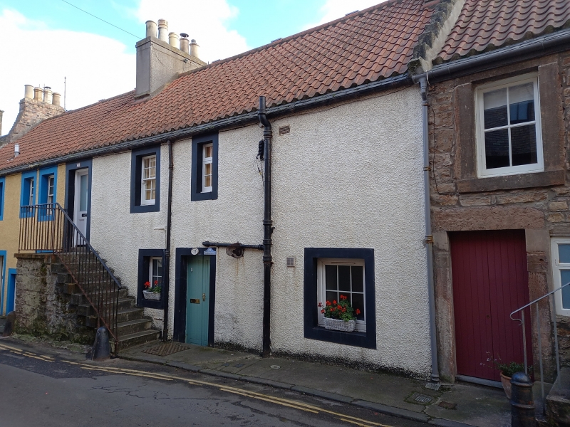
Entry Name: 29, 31 John Street, Cellardyke
Listing Name: Cellardyke, 29-33 John Street
Listing Date: 9 May 1972
Category: B
Source: Historic Scotland
Source ID: 380712
Historic Scotland Designation Reference: LB36017
Building Class: Cultural
Also known as: Cellardyke, 29, 31 John Street
ID on this website: 200380712
Location: Kilrenny
County: Fife
Town: Kilrenny
Electoral Ward: East Neuk and Landward
Traditional County: Fife
Tagged with: Architectural structure
18th century. 2-storey, irregular fenestration, railed forestairs. Painted stucco with margins, pantiled, one chimney badly rebuilt in brick.
External links are from the relevant listing authority and, where applicable, Wikidata. Wikidata IDs may be related buildings as well as this specific building. If you want to add or update a link, you will need to do so by editing the Wikidata entry.


Other nearby listed buildings
