Approximate Location Map
Large Map »
Latitude: 56.2229 / 56°13'22"N
Longitude: -2.7037 / 2°42'13"W
OS Eastings: 356463
OS Northings: 703592
OS Grid: NO564035
Mapcode National: GBR 2V.CY8K
Mapcode Global: WH7SM.FVRB
Plus Code: 9C8V67FW+5G
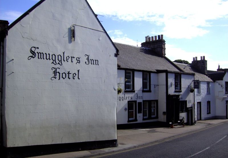
Entry Name: Smuggler's Inn, High Street, Anstruther Easter
Listing Name: Smugglers' Inn High Street, Anstruther Easter
Listing Date: 9 May 1972
Category: B
Source: Historic Scotland
Source ID: 380786
Historic Scotland Designation Reference: LB36078
Building Class: Cultural
Also known as: Anstruther Easter, High Street, Smuggler's Inn
ID on this website: 200380786
Location: Kilrenny
County: Fife
Town: Kilrenny
Electoral Ward: East Neuk and Landward
Traditional County: Fife
Tagged with: Inn
Part late 16th century, much extended 18th and early 19th long rambling composition, 2-storey, semicircular stair tower corbelled to square, Roman doric pilastered porch and doorpiece, semi-elliptical pend arch; whitewashed stucco with painted margins, slated, west part pantiled with slate skirting and slated dormers. Former coaching inn.
External links are from the relevant listing authority and, where applicable, Wikidata. Wikidata IDs may be related buildings as well as this specific building. If you want to add or update a link, you will need to do so by editing the Wikidata entry.


Other nearby listed buildings
