Approximate Location Map
Large Map »
Latitude: 56.2235 / 56°13'24"N
Longitude: -2.7014 / 2°42'4"W
OS Eastings: 356607
OS Northings: 703661
OS Grid: NO566036
Mapcode National: GBR 2V.CYWP
Mapcode Global: WH7SM.GTVV
Plus Code: 9C8V67FX+CF
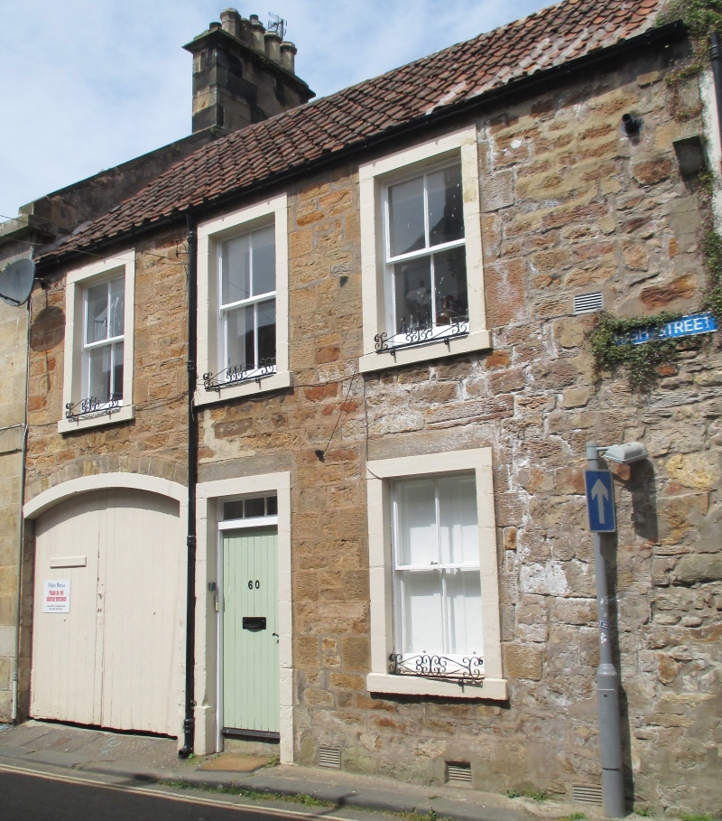
Entry Name: 60 High Street, Anstruther Easter
Listing Name: 60 High Street Anstruther Easter
Listing Date: 9 May 1972
Category: C
Source: Historic Scotland
Source ID: 380820
Historic Scotland Designation Reference: LB36108
Building Class: Cultural
ID on this website: 200380820
Location: Kilrenny
County: Fife
Town: Kilrenny
Electoral Ward: East Neuk and Landward
Traditional County: Fife
Tagged with: Architectural structure
Mid 19th century. 2-storey 3-window rubble with painted
margins, segmentally arched pend, pantiled with slate
skirting.
Re-categorised as C(S) from B for Group (2006). The listing relates specifically to the group interest of the subject. It applies, as always, to interior as well as exterior, as appropriate to building type.
External links are from the relevant listing authority and, where applicable, Wikidata. Wikidata IDs may be related buildings as well as this specific building. If you want to add or update a link, you will need to do so by editing the Wikidata entry.


Other nearby listed buildings
