Approximate Location Map
Large Map »
Latitude: 57.0803 / 57°4'49"N
Longitude: -4.0497 / 4°2'58"W
OS Eastings: 275859
OS Northings: 800673
OS Grid: NH758006
Mapcode National: GBR JBC0.9PK
Mapcode Global: WH4JH.R9RJ
Plus Code: 9C9Q3XJ2+44
Entry Name: Old Parish Churchyard, High Street, Kingussie
Listing Name: High Street, Old Burial Ground and Gate Piers
Listing Date: 20 December 1979
Category: C
Source: Historic Scotland
Source ID: 381024
Historic Scotland Designation Reference: LB36277
Building Class: Cultural
ID on this website: 200381024
Location: Kingussie
County: Highland
Town: Kingussie
Electoral Ward: Badenoch and Strathspey
Traditional County: Inverness-shire
Tagged with: Church building Cemetery
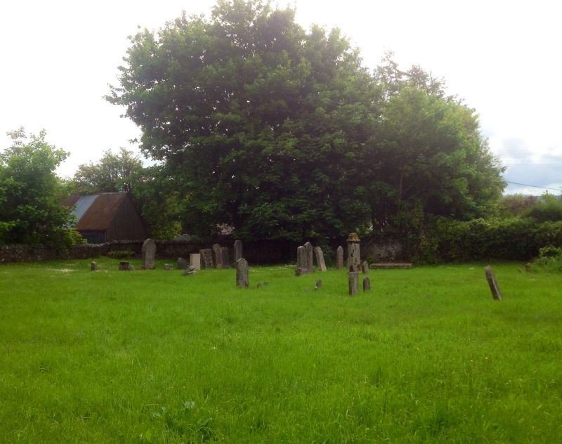
Rubble walled burial ground opening off High Street.
Pedestrian entrance flanked by pair early-mid 18th
cornices and stepped caps supporting ball finials (1 ball
finial missing).
A few 18th and 19th century tombstones.
Probable site of early priory Site of former church of
1624.
External links are from the relevant listing authority and, where applicable, Wikidata. Wikidata IDs may be related buildings as well as this specific building. If you want to add or update a link, you will need to do so by editing the Wikidata entry.


Other nearby listed buildings
