Approximate Location Map
Large Map »
Latitude: 56.2054 / 56°12'19"N
Longitude: -3.4236 / 3°25'24"W
OS Eastings: 311784
OS Northings: 702338
OS Grid: NO117023
Mapcode National: GBR 1Z.F4TB
Mapcode Global: WH6RB.C9Y5
Plus Code: 9C8R6H4G+5H
Entry Name: Kinross Parish Church And Churchyard, Station Road, Kinross
Listing Name: Kinross West, Church of Scotland, (Kinross Parish Kirk) Station Road.
Listing Date: 5 October 1971
Category: B
Source: Historic Scotland
Source ID: 381033
Historic Scotland Designation Reference: LB36283
Building Class: Cultural
Also known as: Kinross, Station Road, Kinross Parish Church And Churchyard
ID on this website: 200381033
Location: Kinross
County: Perth and Kinross
Town: Kinross
Electoral Ward: Kinross-shire
Traditional County: Kinross-shire
Tagged with: Church building Churchyard
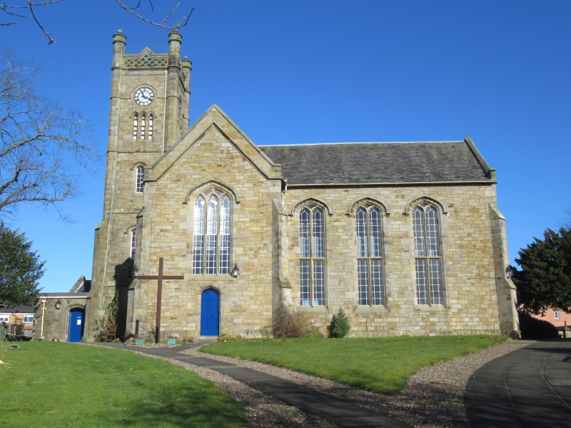
1832. George Angus, architect. Gothic Revival. Large hall
with tower at W. end. Rubble. Buttresses. Mullioned-and-
transomed window. Slated roof. Interior: Galleries on 3
sides. Mural tablets to Grahams of Kinross.
In ecclesiastical use. Superseded second parish kirk
(built 1742)
External links are from the relevant listing authority and, where applicable, Wikidata. Wikidata IDs may be related buildings as well as this specific building. If you want to add or update a link, you will need to do so by editing the Wikidata entry.


Other nearby listed buildings
