Approximate Location Map
Large Map »
Latitude: 54.8357 / 54°50'8"N
Longitude: -4.0494 / 4°2'57"W
OS Eastings: 268468
OS Northings: 550915
OS Grid: NX684509
Mapcode National: GBR 0D5J.39
Mapcode Global: WH4WB.RQW6
Plus Code: 9C6QRXP2+76
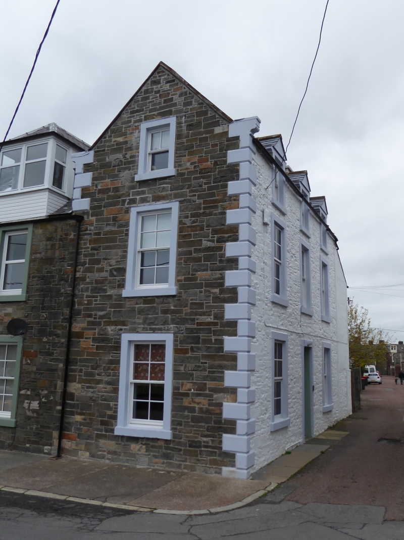
Entry Name: 11 Church Place, Kirkcudbright
Listing Name: 11 Church Place
Listing Date: 28 May 1981
Category: C
Source: Historic Scotland
Source ID: 381289
Historic Scotland Designation Reference: LB36499
Building Class: Cultural
ID on this website: 200381289
Location: Kirkcudbright
County: Dumfries and Galloway
Town: Kirkcudbright
Electoral Ward: Dee and Glenkens
Traditional County: Kirkcudbrightshire
Tagged with: Terrace house
Circa 1860. End terraced house. Main elevation, 3-storeys, 3-bays to Mews Lane, gable end to St Mary's Place. Squared, snecked rubble with painted margins and rusticated quoins. Central door, blind windows at ground and 1st in left bay. 3 2nd floor windows with wallhead gables. 1 window in each storey on gabel end. Straight skews, end stacks, slate roof. Lower lean-to addition at right.
External links are from the relevant listing authority and, where applicable, Wikidata. Wikidata IDs may be related buildings as well as this specific building. If you want to add or update a link, you will need to do so by editing the Wikidata entry.


Other nearby listed buildings
