Latitude: 54.8347 / 54°50'4"N
Longitude: -4.0524 / 4°3'8"W
OS Eastings: 268275
OS Northings: 550802
OS Grid: NX682508
Mapcode National: GBR 0D4J.GP
Mapcode Global: WH4WB.QRH1
Plus Code: 9C6QRWMX+V2
Entry Name: 142 High Street, Kirkcudbright
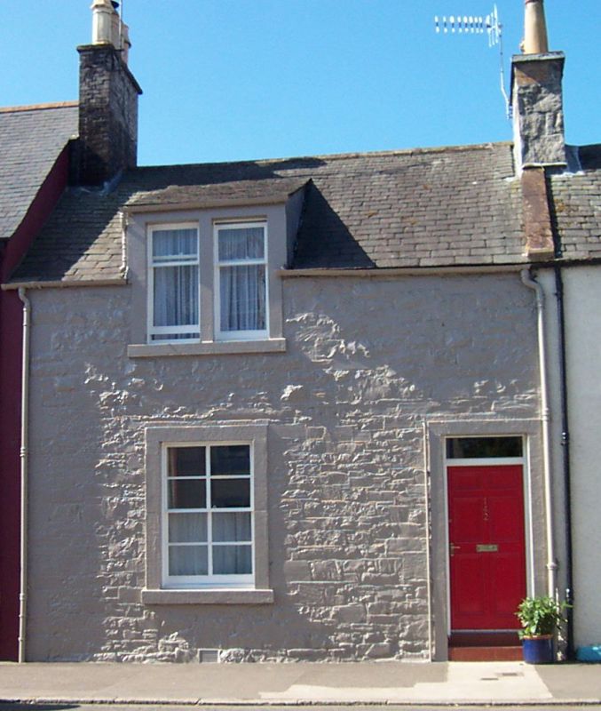
Listing Name: 142 High Street
Listing Date: 4 November 1971
Category: C
Source: Historic Scotland
Source ID: 381376
Historic Scotland Designation Reference: LB36561
Building Class: Cultural
ID on this website: 200381376
Location: Kirkcudbright
County: Dumfries and Galloway
Town: Kirkcudbright
Electoral Ward: Dee and Glenkens
Traditional County: Kirkcudbrightshire
Tagged with: Architectural structure
Early 19th century. Terraced house. 2-storeys, 2-bays. Oainted rubble and margins. Panelled door in right bay, window with lying-pane glazing to left. 1st floor bipartite raised through eaves, with swept roof. Slate roof.
External links are from the relevant listing authority and, where applicable, Wikidata. Wikidata IDs may be related buildings as well as this specific building. If you want to add or update a link, you will need to do so by editing the Wikidata entry.


Other nearby listed buildings