Latitude: 54.8373 / 54°50'14"N
Longitude: -4.0482 / 4°2'53"W
OS Eastings: 268552
OS Northings: 551089
OS Grid: NX685510
Mapcode National: GBR 0D5H.CR
Mapcode Global: WH4WB.SPG0
Plus Code: 9C6QRXP2+WP
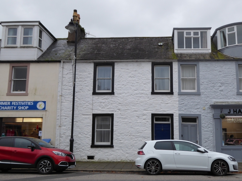
Entry Name: 51 St Mary Street, Kirkcudbright
Listing Name: 51 St Mary`s Street
Listing Date: 28 May 1981
Category: C
Source: Historic Scotland
Source ID: 381433
Historic Scotland Designation Reference: LB36614
Building Class: Cultural
ID on this website: 200381433
Location: Kirkcudbright
County: Dumfries and Galloway
Town: Kirkcudbright
Electoral Ward: Dee and Glenkens
Traditional County: Kirkcudbrightshire
Tagged with: Architectural structure
Early 19th century. Terraced house. 2-storeys, 2-bays. Painted rubble with contrasting margins. Door at right, 2 windows in 1st floor. Slate roof.
External links are from the relevant listing authority and, where applicable, Wikidata. Wikidata IDs may be related buildings as well as this specific building. If you want to add or update a link, you will need to do so by editing the Wikidata entry.


Other nearby listed buildings