Approximate Location Map
Large Map »
Latitude: 55.1286 / 55°7'42"N
Longitude: -3.4413 / 3°26'28"W
OS Eastings: 308195
OS Northings: 582527
OS Grid: NY081825
Mapcode National: GBR 49D4.RB
Mapcode Global: WH6XK.3CK6
Plus Code: 9C7R4HH5+CF
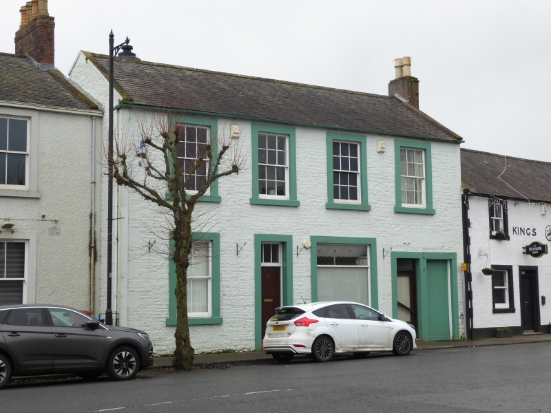
Entry Name: 19 High Street, Lochmaben
Listing Name: 17, 19 High Street
Listing Date: 3 August 1971
Category: C
Source: Historic Scotland
Source ID: 382659
Historic Scotland Designation Reference: LB37544
Building Class: Cultural
ID on this website: 200382659
Location: Lochmaben
County: Dumfries and Galloway
Town: Lochmaben
Electoral Ward: Annandale North
Traditional County: Dumfriesshire
Tagged with: Architectural structure
Mid 19th century. 2 storeys, 4 bays, door in 2nd bay with
tall fanlight, shop window in 3rd, 2 doorways in right bay
(? originally a wide pend). Painted coursed rubble, ashlar
margins and projecting cills. 1st floor sash windows have
12-pane glazing pattern. Skews; end stacks, one shared with
Kings Arms, the other removed; slate roof.
Change of Category B to C(S) 4.10.88.
External links are from the relevant listing authority and, where applicable, Wikidata. Wikidata IDs may be related buildings as well as this specific building. If you want to add or update a link, you will need to do so by editing the Wikidata entry.


Other nearby listed buildings
