Approximate Location Map
Large Map »
Latitude: 55.9435 / 55°56'36"N
Longitude: -3.048 / 3°2'52"W
OS Eastings: 334643
OS Northings: 672768
OS Grid: NT346727
Mapcode National: GBR 2F.YK6F
Mapcode Global: WH7TT.4WV0
Plus Code: 9C7RWXV2+9R
Entry Name: 47 High Street, Musselburgh
Listing Name: 47 High Street
Listing Date: 15 May 1985
Category: B
Source: Historic Scotland
Source ID: 383528
Historic Scotland Designation Reference: LB38302
Building Class: Cultural
Also known as: Musselburgh, 47 High Street
ID on this website: 200383528
Location: Musselburgh
County: East Lothian
Town: Musselburgh
Electoral Ward: Musselburgh
Traditional County: Midlothian
Tagged with: House
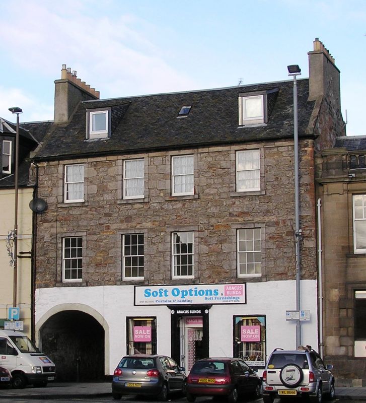
Early 19th century, 3 storey and attics house, with ground
floor modified as shop, 4 windows wide. Slate roof with end
stacks, coursed rubble with raised 1st and 2nd floor
windows margins and eaves band course. Ground floor has
wide round arched pend on left, shop with corniced
doorpiece windows to right. 2 small modern square dormers,
2nd floor windows 6 pane sash, 1st floor reglazed as shop
windows, 2 window wing of same height fronting lane within
pend.
External links are from the relevant listing authority and, where applicable, Wikidata. Wikidata IDs may be related buildings as well as this specific building. If you want to add or update a link, you will need to do so by editing the Wikidata entry.


Other nearby listed buildings
