Approximate Location Map
Large Map »
Latitude: 57.5832 / 57°34'59"N
Longitude: -3.871 / 3°52'15"W
OS Eastings: 288226
OS Northings: 856335
OS Grid: NH882563
Mapcode National: GBR J8TP.7HD
Mapcode Global: WH4G2.HNWJ
Plus Code: 9C9RH4MH+7H
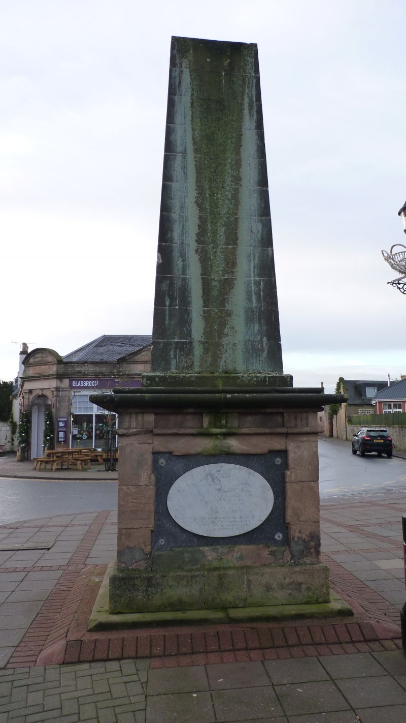
Entry Name: Straith Monument, High Street, Nairn
Listing Name: High Street, Straith Monument
Listing Date: 12 March 1981
Category: C
Source: Historic Scotland
Source ID: 383780
Historic Scotland Designation Reference: LB38421
Building Class: Cultural
ID on this website: 200383780
Location: Nairn
County: Highland
Town: Nairn
Electoral Ward: Nairn and Cawdor
Traditional County: Nairnshire
Tagged with: Monument
1816. Squat ashlar obelisk on square corniced plinth and
stepped base. Inscription on oval marble plaque placed below
triglyph cornice.
Sketch furnished by Sir Thomas Dick Lauder of Relugas, Moray.
John Straith, 1732-1807, was parish school-master for forty
years.
External links are from the relevant listing authority and, where applicable, Wikidata. Wikidata IDs may be related buildings as well as this specific building. If you want to add or update a link, you will need to do so by editing the Wikidata entry.


Other nearby listed buildings
