Latitude: 57.5041 / 57°30'14"N
Longitude: -1.7769 / 1°46'36"W
OS Eastings: 413467
OS Northings: 846009
OS Grid: NK134460
Mapcode National: GBR P8ZW.LL1
Mapcode Global: WHBQ8.PN14
Plus Code: 9C9WG63F+J6
Entry Name: 7 Saint Andrew Street, Peterhead
Listing Name: 7 St. Andrew Street
Listing Date: 16 April 1971
Category: C
Source: Historic Scotland
Source ID: 385482
Historic Scotland Designation Reference: LB39703
Building Class: Cultural
ID on this website: 200385482
Location: Peterhead
County: Aberdeenshire
Town: Peterhead
Electoral Ward: Peterhead North and Rattray
Traditional County: Aberdeenshire
Tagged with: House
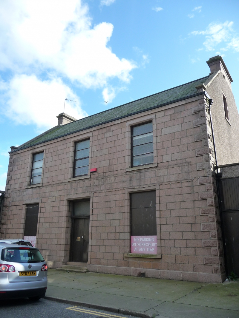
Circa 1845. Set back from street line. 2-storey 3-window granite ashlar with bull-faced quoins and chamfered
margins, tripartite doorpiece.
James Street was largely built up in Ainslie's map of C. 1800. The area South of Broad Street was laid out but
unbuilt in 1771 except for a few modern sized detached houses and a row of artisan cottages on the east side
of Jamaica Street, replaced c. 1790. The rise in thread and textile manufacture and the popularity of Peterhead
as a spa resulted in the rapid development of this area in the 1790s when land here was worth £1150 an acre. In 1795 it was noted 'a great number of houses, where elegant lodgings may be found, have been erected by the inhabitants merely with a view to accomodate strangers'. By 1836 the thread and textile industry had collapsed; the Wine Well and Baths were demolished 1931. Except for no. 7 and nos. 18 & 20 St. Andrew Street was completely built up in Ainslie's maps of 1800/05.
External links are from the relevant listing authority and, where applicable, Wikidata. Wikidata IDs may be related buildings as well as this specific building. If you want to add or update a link, you will need to do so by editing the Wikidata entry.


Other nearby listed buildings