Approximate Location Map
Large Map »
Latitude: 56.2132 / 56°12'47"N
Longitude: -2.7306 / 2°43'50"W
OS Eastings: 354784
OS Northings: 702533
OS Grid: NO547025
Mapcode National: GBR 2T.DJH1
Mapcode Global: WH7ST.1306
Plus Code: 9C8V6779+7Q
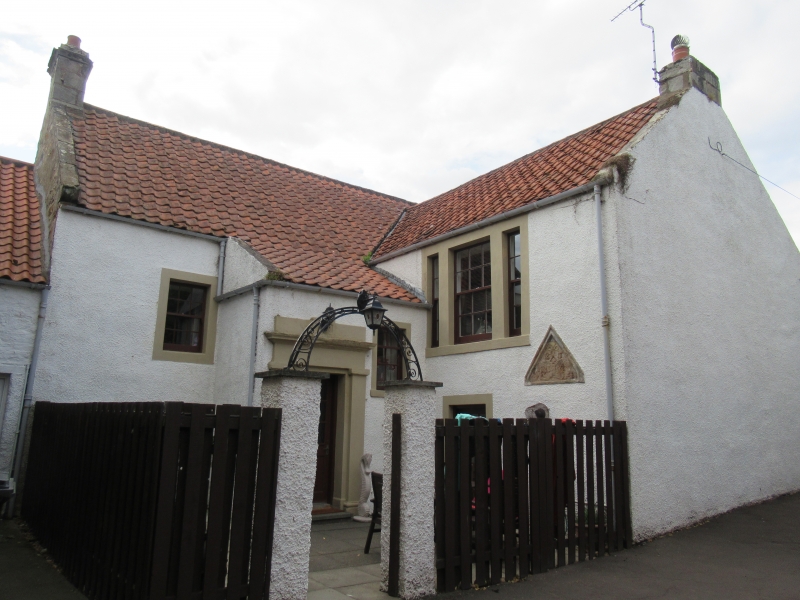
Entry Name: 1 Brown's Close, Pittenweem
Listing Name: House in Brown's Close, Adjoining Old Golf Tavern, and British Legion Building at Rear.
Listing Date: 18 August 1972
Category: B
Source: Historic Scotland
Source ID: 385787
Historic Scotland Designation Reference: LB39909
Building Class: Cultural
Also known as: Pittenweem, 1 Brown's Close
ID on this website: 200385787
Location: Pittenweem
County: Fife
Town: Pittenweem
Electoral Ward: East Neuk and Landward
Traditional County: Fife
Tagged with: Architectural structure
Dated 1617 on inset pediment, reconstructed 1812 (dated). 2-storey colour-washed rubble and pantile with later projecting east wing, pilastered porch in neutrant angle; chamfered openings; slated, single storey cottage (now hall) at rear.
External links are from the relevant listing authority and, where applicable, Wikidata. Wikidata IDs may be related buildings as well as this specific building. If you want to add or update a link, you will need to do so by editing the Wikidata entry.


Other nearby listed buildings
