Approximate Location Map
Large Map »
Latitude: 56.2133 / 56°12'47"N
Longitude: -2.7293 / 2°43'45"W
OS Eastings: 354862
OS Northings: 702540
OS Grid: NO548025
Mapcode National: GBR 2T.DJRT
Mapcode Global: WH7ST.13L4
Plus Code: 9C8V677C+87
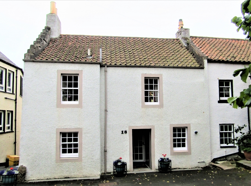
Entry Name: 18 High Street, Pittenweem
Listing Name: 18 High Street
Listing Date: 18 August 1972
Category: C
Source: Historic Scotland
Source ID: 385798
Historic Scotland Designation Reference: LB39918
Building Class: Cultural
ID on this website: 200385798
Location: Pittenweem
County: Fife
Town: Pittenweem
Electoral Ward: East Neuk and Landward
Traditional County: Fife
Tagged with: Architectural structure
18th century. 2-storey 2-window harled with masonry lining out, gable dormer heads to 1st floor windows, crowstepped gable to Water Wynd. Segmentally arched pend inserted through original ground floor.
Re-categorised as C(S) from B for Group (2006). The listing relates specifically to the group interest of the subject. It applies, as always, to interior as well as exterior, as appropriate to building type.
External links are from the relevant listing authority and, where applicable, Wikidata. Wikidata IDs may be related buildings as well as this specific building. If you want to add or update a link, you will need to do so by editing the Wikidata entry.


Other nearby listed buildings
