Approximate Location Map
Large Map »
Latitude: 56.2129 / 56°12'46"N
Longitude: -2.7278 / 2°43'40"W
OS Eastings: 354954
OS Northings: 702498
OS Grid: NO549024
Mapcode National: GBR 2T.DK46
Mapcode Global: WH7ST.239F
Plus Code: 9C8V677C+5V
Entry Name: 16 East Shore, Pittenweem
Listing Name: 16 East Shore
Listing Date: 18 August 1972
Category: C
Source: Historic Scotland
Source ID: 385857
Historic Scotland Designation Reference: LB39977
Building Class: Cultural
ID on this website: 200385857
Location: Pittenweem
County: Fife
Town: Pittenweem
Electoral Ward: East Neuk and Landward
Traditional County: Fife
Tagged with: Architectural structure
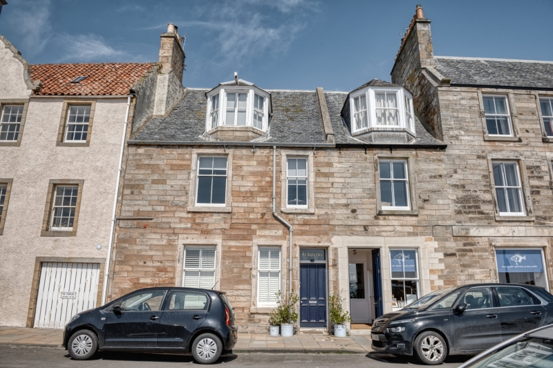
Circa 1880, Plain 2-storey and attic 3-window, coursed rubble with margins, inserted garage. Slated, 2 canted dormers.
Re-categorised as C(S) from B for Group (2006). The listing relates specifically to the group interest of the subject. It applies, as always, to interior as well as exterior, as appropriate to building type.
External links are from the relevant listing authority and, where applicable, Wikidata. Wikidata IDs may be related buildings as well as this specific building. If you want to add or update a link, you will need to do so by editing the Wikidata entry.


Other nearby listed buildings
