Latitude: 56.2118 / 56°12'42"N
Longitude: -2.7319 / 2°43'54"W
OS Eastings: 354702
OS Northings: 702372
OS Grid: NO547023
Mapcode National: GBR 2T.DQ5P
Mapcode Global: WH7ST.04D9
Plus Code: 9C8V6769+P7
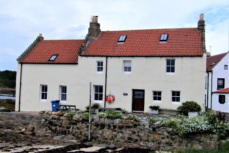
Entry Name: Rockvilla, 42 Mid Shore, Pittenweem
Listing Name: Rockvilla Mid Shore
Listing Date: 18 August 1972
Category: B
Source: Historic Scotland
Source ID: 385897
Historic Scotland Designation Reference: LB40014
Building Class: Cultural
Also known as: Pittenweem, 42 Mid Shore, Rockvilla
ID on this website: 200385897
Location: Pittenweem
County: Fife
Town: Pittenweem
Electoral Ward: East Neuk and Landward
Traditional County: Fife
Tagged with: House
18th century. 2-storey 3-window, unfortunate modern dry dash harl on E front, remainder unaltered with original harl, crowstepped; seaward wing altered to garage, single storey and loft, piended roof. Built or rock foundation jutting into
External links are from the relevant listing authority and, where applicable, Wikidata. Wikidata IDs may be related buildings as well as this specific building. If you want to add or update a link, you will need to do so by editing the Wikidata entry.


Other nearby listed buildings