Latitude: 56.3388 / 56°20'19"N
Longitude: -2.799 / 2°47'56"W
OS Eastings: 350702
OS Northings: 716552
OS Grid: NO507165
Mapcode National: GBR 2R.4M3F
Mapcode Global: WH7RZ.ZY90
Plus Code: 9C8V86Q2+GC
Entry Name: 134 South Street, St Andrews
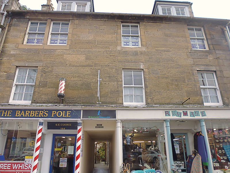
Listing Name: 134-138 South Street.
Listing Date: 23 February 1971
Category: C
Source: Historic Scotland
Source ID: 386680
Historic Scotland Designation Reference: LB40710
Building Class: Cultural
ID on this website: 200386680
Location: St Andrews
County: Fife
Town: St Andrews
Electoral Ward: St Andrews
Traditional County: Fife
Tagged with: Architectural structure
Early 19th century 3-storey and attic, 3-window droved ashlar and slate with 2 piended dormers; ground floor painted with good pillared shop fronts; neat modern window alteration at 2nd floor.
Re-categorised as C(S) from B for Group (2006). The listing relates specifically to the group interest of the subject. It applies, as always, to interior as well as exterior, as appropriate to building type.
External links are from the relevant listing authority and, where applicable, Wikidata. Wikidata IDs may be related buildings as well as this specific building. If you want to add or update a link, you will need to do so by editing the Wikidata entry.


Other nearby listed buildings