Approximate Location Map
Large Map »
Latitude: 56.3401 / 56°20'24"N
Longitude: -2.8002 / 2°48'0"W
OS Eastings: 350628
OS Northings: 716698
OS Grid: NO506166
Mapcode National: GBR 2R.4DTZ
Mapcode Global: WH7RZ.YXQ0
Plus Code: 9C8V85RX+2W
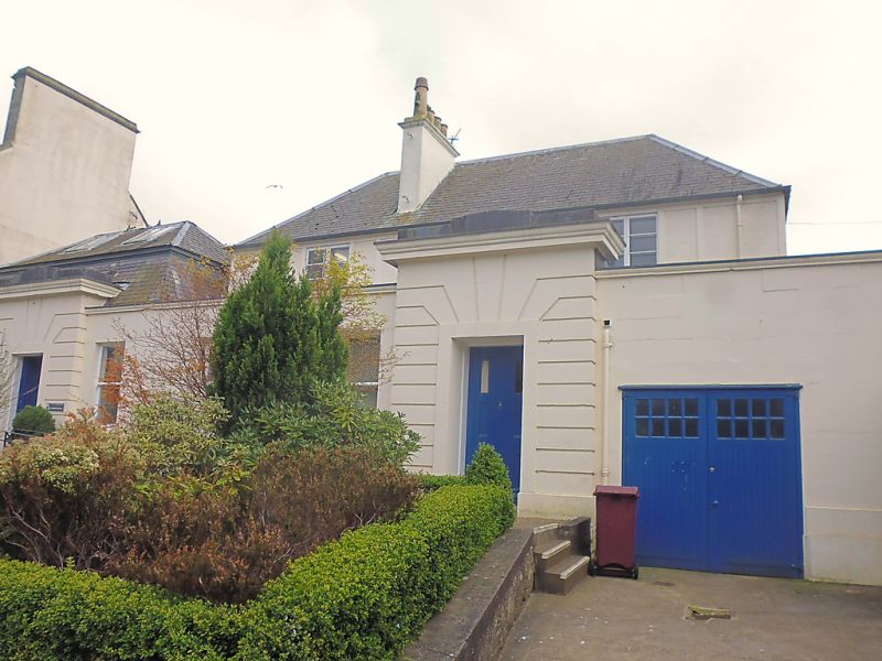
Entry Name: 6 St Mary's Place, St Andrews
Listing Name: 6 St. Mary's Place.
Listing Date: 8 June 1978
Category: C
Source: Historic Scotland
Source ID: 386734
Historic Scotland Designation Reference: LB40754
Building Class: Cultural
ID on this website: 200386734
Location: St Andrews
County: Fife
Town: St Andrews
Electoral Ward: St Andrews
Traditional County: Fife
Tagged with: Architectural structure
c 1840. Single storey, 4-window; ashlar with channelled voussoired doorpieces; altered at roof and at back.
For prolonged period studio of T Roger, photographic pioneer.
External links are from the relevant listing authority and, where applicable, Wikidata. Wikidata IDs may be related buildings as well as this specific building. If you want to add or update a link, you will need to do so by editing the Wikidata entry.


Other nearby listed buildings
