Approximate Location Map
Large Map »
Latitude: 56.3413 / 56°20'28"N
Longitude: -2.7968 / 2°47'48"W
OS Eastings: 350838
OS Northings: 716831
OS Grid: NO508168
Mapcode National: GBR 2R.4FKW
Mapcode Global: WH7S0.0WG2
Plus Code: 9C8V86R3+G7
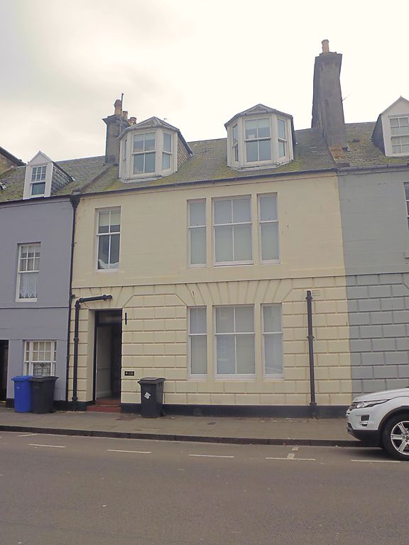
Entry Name: 120 North Street, St Andrews
Listing Name: 120 North Street.
Listing Date: 23 February 1971
Category: B
Source: Historic Scotland
Source ID: 386793
Historic Scotland Designation Reference: LB40799
Building Class: Cultural
Also known as: St Andrews, 120 North Street
ID on this website: 200386793
Location: St Andrews
County: Fife
Town: St Andrews
Electoral Ward: St Andrews
Traditional County: Fife
Tagged with: Architectural structure
Early 19th cent. 2-storey and attic, 2-window (1 window
tripartite), ground floor rusticated; slated, 2 canted
dormers.
External links are from the relevant listing authority and, where applicable, Wikidata. Wikidata IDs may be related buildings as well as this specific building. If you want to add or update a link, you will need to do so by editing the Wikidata entry.


Other nearby listed buildings
