Latitude: 56.3422 / 56°20'32"N
Longitude: -2.8017 / 2°48'6"W
OS Eastings: 350539
OS Northings: 716942
OS Grid: NO505169
Mapcode National: GBR 2R.46JF
Mapcode Global: WH7RZ.YV0B
Plus Code: 9C8V85RX+V8
Entry Name: 5 Pilmour Place, St Andrews
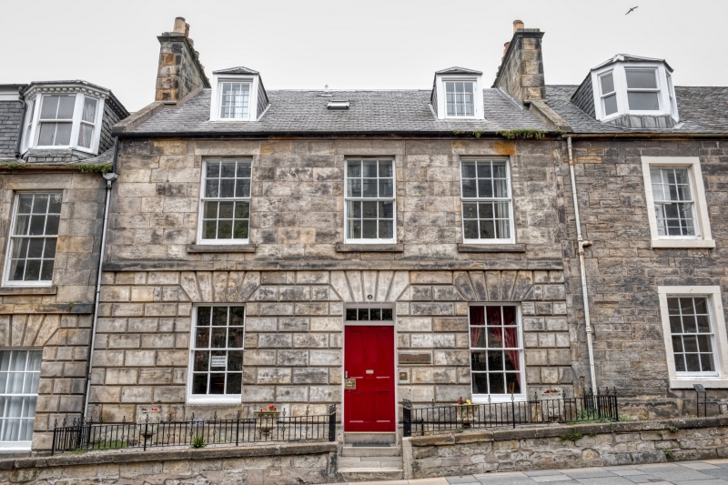
Listing Name: 5-7 Pilmour Place.
Listing Date: 23 February 1971
Category: B
Source: Historic Scotland
Source ID: 386814
Historic Scotland Designation Reference: LB40808
Building Class: Cultural
Also known as: St Andrews, 5 Pilmour Place
ID on this website: 200386814
Location: St Andrews
County: Fife
Town: St Andrews
Electoral Ward: St Andrews
Traditional County: Fife
Tagged with: Architectural structure
Begun 1820. 2-storey and attic, 9-window ashlar with
channelled ground floor, stepped to slope; slated, attics
partly altered, detail varies.
External links are from the relevant listing authority and, where applicable, Wikidata. Wikidata IDs may be related buildings as well as this specific building. If you want to add or update a link, you will need to do so by editing the Wikidata entry.


Other nearby listed buildings