Approximate Location Map
Large Map »
Latitude: 56.3409 / 56°20'27"N
Longitude: -2.7884 / 2°47'18"W
OS Eastings: 351361
OS Northings: 716782
OS Grid: NO513167
Mapcode National: GBR 2R.4HHT
Mapcode Global: WH7S0.4WGC
Plus Code: 9C8V86R6+9J
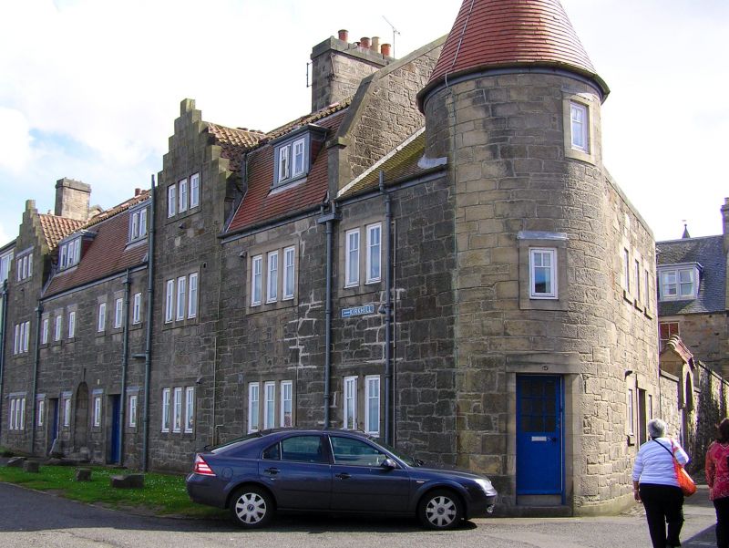
Entry Name: 1-8 St Gregory's, East Scores, St Andrews
Listing Name: 1-8 St. Gregory's East Scores and Gregory's Lane.
Listing Date: 8 June 1978
Category: C
Source: Historic Scotland
Source ID: 386827
Historic Scotland Designation Reference: LB40812
Building Class: Cultural
ID on this website: 200386827
Location: St Andrews
County: Fife
Town: St Andrews
Electoral Ward: St Andrews
Traditional County: Fife
Tagged with: Architectural structure
1925, Paul Waterhouse, architect. 2-storey and mansard attic
with 3 swept dormers, rubble, tile and pantile; crowstepped
gables and circular corner tower.
External links are from the relevant listing authority and, where applicable, Wikidata. Wikidata IDs may be related buildings as well as this specific building. If you want to add or update a link, you will need to do so by editing the Wikidata entry.


Other nearby listed buildings
