Approximate Location Map
Large Map »
Latitude: 56.3408 / 56°20'26"N
Longitude: -2.7905 / 2°47'25"W
OS Eastings: 351230
OS Northings: 716771
OS Grid: NO512167
Mapcode National: GBR 2R.4H0H
Mapcode Global: WH7S0.3WGG
Plus Code: 9C8V86R5+8R
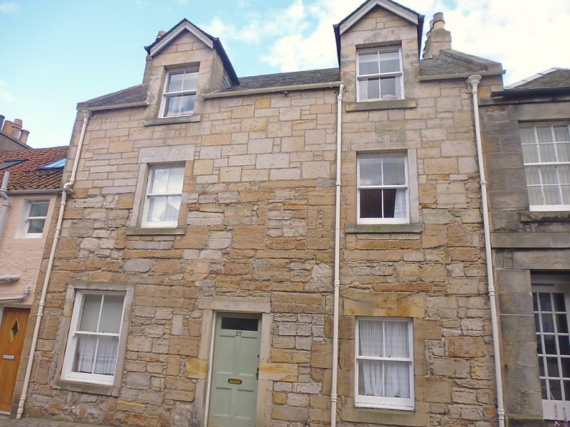
Entry Name: 27 North Castle Street, St Andrews
Listing Name: 27 North Castle Street
Listing Date: 23 February 1971
Category: C
Source: Historic Scotland
Source ID: 386887
Historic Scotland Designation Reference: LB40851
Building Class: Cultural
ID on this website: 200386887
Location: St Andrews
County: Fife
Town: St Andrews
Electoral Ward: St Andrews
Traditional County: Fife
Tagged with: Architectural structure
Early 19th century. 2-storey and attic, heightened with stone semi-dormers mid 19th century; 2-window; original work droved
rubble, painted, upper part stugged, slated, 2 dormers.
Re-categorised as C(S) from B for Group (2006). The listing relates specifically to the group interest of the subject. It applies, as always, to interior as well as exterior, as appropriate to building type.
External links are from the relevant listing authority and, where applicable, Wikidata. Wikidata IDs may be related buildings as well as this specific building. If you want to add or update a link, you will need to do so by editing the Wikidata entry.


Other nearby listed buildings
