Latitude: 56.3412 / 56°20'28"N
Longitude: -2.8017 / 2°48'6"W
OS Eastings: 350536
OS Northings: 716827
OS Grid: NO505168
Mapcode National: GBR 2R.4DHP
Mapcode Global: WH7RZ.YW04
Plus Code: 9C8V85RX+F8
Entry Name: General, Howard Place, St Andrews
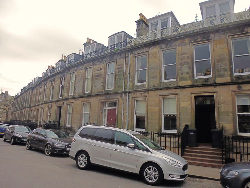
Listing Name: 1-15 Howard Place.
Listing Date: 28 April 1959
Category: B
Source: Historic Scotland
Source ID: 386984
Historic Scotland Designation Reference: LB40903
Building Class: Cultural
Also known as: St Andrews, Howard Place, General
ID on this website: 200386984
Location: St Andrews
County: Fife
Town: St Andrews
Electoral Ward: St Andrews
Traditional County: Fife
Tagged with: Architectural structure
1860s, John Chesser. Classic, ashlar; Nos. 1-7 2-storey
basement and attic with c.i. parapet at wallhead; Nos. 8-15
3-storey part with attic, consoled doorpiece at 15; openings
architraved throughout; slated.
External links are from the relevant listing authority and, where applicable, Wikidata. Wikidata IDs may be related buildings as well as this specific building. If you want to add or update a link, you will need to do so by editing the Wikidata entry.


Other nearby listed buildings