Approximate Location Map
Large Map »
Latitude: 56.2066 / 56°12'23"N
Longitude: -2.7657 / 2°45'56"W
OS Eastings: 352596
OS Northings: 701822
OS Grid: NO525018
Mapcode National: GBR 2S.DW0Z
Mapcode Global: WH7SS.H868
Plus Code: 9C8V664M+JP
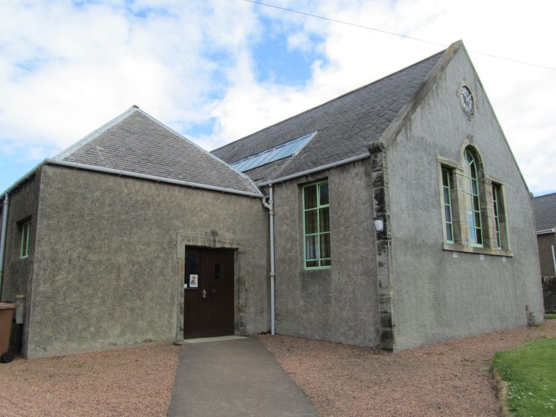
Entry Name: Hall, St Monance Parish Church, Station Road, St Monance
Listing Name: Parish Church Hall Station Road
Listing Date: 18 August 1972
Category: B
Source: Historic Scotland
Source ID: 387100
Historic Scotland Designation Reference: LB41007
Building Class: Cultural
Also known as: St Monance, Station Road, St Monance Parish Church, Hall
ID on this website: 200387100
Location: St Monance
County: Fife
Town: St Monance
Electoral Ward: East Neuk and Landward
Traditional County: Fife
Tagged with: Church building
Sir Robert Lorimer 1913. Single storey gable front with venetian window, clock and scroll skews; parallel piended section with architraved and keyblocked doorpiece; harled and slated.
External links are from the relevant listing authority and, where applicable, Wikidata. Wikidata IDs may be related buildings as well as this specific building. If you want to add or update a link, you will need to do so by editing the Wikidata entry.


Other nearby listed buildings
