Approximate Location Map
Large Map »
Latitude: 56.2052 / 56°12'18"N
Longitude: -2.7655 / 2°45'55"W
OS Eastings: 352609
OS Northings: 701658
OS Grid: NO526016
Mapcode National: GBR 2S.F2MY
Mapcode Global: WH7SS.H9BD
Plus Code: 9C8V664M+3R
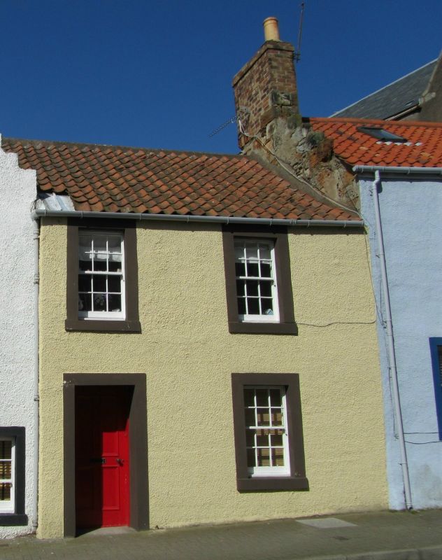
Entry Name: 2 Station Road, St Monance
Listing Name: 2 Station Road
Listing Date: 18 August 1972
Category: C
Source: Historic Scotland
Source ID: 387101
Historic Scotland Designation Reference: LB41008
Building Class: Cultural
ID on this website: 200387101
Location: St Monance
County: Fife
Town: St Monance
Electoral Ward: East Neuk and Landward
Traditional County: Fife
Tagged with: Architectural structure
Early 19th century, altered. 2-storey 1-window, modern dry dash harl with margins, pantiled. Under reconstruction 1972.
Re-categorised as C(S) from B for Group (2006). The listing relates specifically to the group interest of the subject. It applies, as always, to interior as well as exterior, as appropriate to building type.
External links are from the relevant listing authority and, where applicable, Wikidata. Wikidata IDs may be related buildings as well as this specific building. If you want to add or update a link, you will need to do so by editing the Wikidata entry.


Other nearby listed buildings
