Approximate Location Map
Large Map »
Latitude: 56.1191 / 56°7'8"N
Longitude: -3.9372 / 3°56'13"W
OS Eastings: 279655
OS Northings: 693506
OS Grid: NS796935
Mapcode National: GBR 1C.LHFM
Mapcode Global: WH4P6.HGCD
Plus Code: 9C8R4397+J4
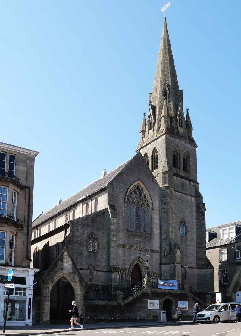
Entry Name: South Church, 67-69 Murray Place, Stirling
Listing Name: South Church 67 Murray Place
Listing Date: 4 November 1965
Category: B
Source: Historic Scotland
Source ID: 387194
Historic Scotland Designation Reference: LB41098
Building Class: Cultural
Also known as: Stirling, 67-69 Murray Place, South Church
ID on this website: 200387194
Location: Stirling
County: Stirling
Town: Stirling
Electoral Ward: Stirling North
Traditional County: Stirlingshire
Tagged with: Church building
J, W H and J M Hay, Liverpool 1851-3. Late Decorated style.
Rubble-built 5-bay nave aisled with clerestory, apsed at SW,
NE gable front to Murray Place, NW tower with octagonal stair
turret, 2 lancets belfry stage, stone spire of good outline
with pinnacled broaches and lucarnes, elevated site with twin
archway and perron.
Former Free Church Standing empty 1976
External links are from the relevant listing authority and, where applicable, Wikidata. Wikidata IDs may be related buildings as well as this specific building. If you want to add or update a link, you will need to do so by editing the Wikidata entry.


Other nearby listed buildings
