Latitude: 56.118 / 56°7'4"N
Longitude: -3.9382 / 3°56'17"W
OS Eastings: 279589
OS Northings: 693391
OS Grid: NS795933
Mapcode National: GBR 1C.LH7F
Mapcode Global: WH4P6.GHW6
Plus Code: 9C8R4396+6P
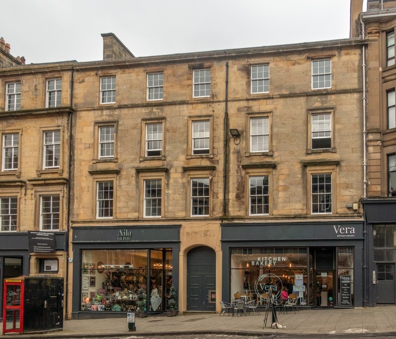
Entry Name: 47-51 King Street, Stirling
Listing Name: King Street 47, 49, 51
Listing Date: 3 February 1978
Category: B
Source: Historic Scotland
Source ID: 387529
Historic Scotland Designation Reference: LB41333
Building Class: Cultural
Also known as: Stirling, 47-51 King Street
ID on this website: 200387529
Location: Stirling
County: Stirling
Town: Stirling
Electoral Ward: Stirling North
Traditional County: Stirlingshire
Tagged with: Tenement
Mid/late 19th century, plain late classic 4-storey 5-window
ashlar facade, architraves at 1st and 2nd floors, with
cornices at 1st ground floor shop altered: main cornice and
blocking course.
External links are from the relevant listing authority and, where applicable, Wikidata. Wikidata IDs may be related buildings as well as this specific building. If you want to add or update a link, you will need to do so by editing the Wikidata entry.


Other nearby listed buildings