Approximate Location Map
Large Map »
Latitude: 56.1255 / 56°7'31"N
Longitude: -3.9415 / 3°56'29"W
OS Eastings: 279406
OS Northings: 694230
OS Grid: NS794942
Mapcode National: GBR 1C.L2GM
Mapcode Global: WH4P6.F99F
Plus Code: 9C8R43G5+69
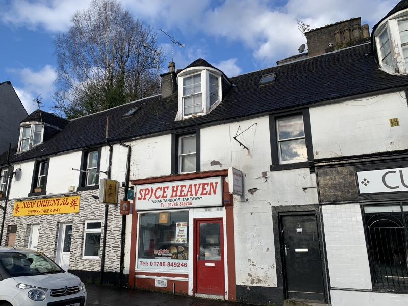
Entry Name: 1-9 Lower Bridge Street, Stirling
Listing Name: Lower Bridge Street 1-9
Listing Date: 3 February 1978
Category: C
Source: Historic Scotland
Source ID: 387543
Historic Scotland Designation Reference: LB41346
Building Class: Cultural
ID on this website: 200387543
Location: Stirling
County: Stirling
Town: Stirling
Electoral Ward: Stirling North
Traditional County: Stirlingshire
Tagged with: House
18th century. 2-storey and attic, 2 houses each 3-window wide
at 1st floor, ground floor shops.
Stuccoed with margins. 2 canted dormers with bow-fronted
roofs to no 9. Slated roof.
External links are from the relevant listing authority and, where applicable, Wikidata. Wikidata IDs may be related buildings as well as this specific building. If you want to add or update a link, you will need to do so by editing the Wikidata entry.


Other nearby listed buildings
