Latitude: 57.5011 / 57°30'4"N
Longitude: -2.0468 / 2°2'48"W
OS Eastings: 397296
OS Northings: 845658
OS Grid: NJ972456
Mapcode National: GBR P89W.WJ7
Mapcode Global: WH9P0.JQKF
Plus Code: 9C9VGX23+C7
Entry Name: Grain Mill, Mill Street, Stuartfield - North building
Listing Name: Grain Mill, 31 Mill Street, Stuartfield
Listing Date: 16 April 1971
Category: B
Source: Historic Scotland
Source ID: 407735
Historic Scotland Designation Reference: LB16102
Building Class: Cultural
ID on this website: 200407735
Location: Old Deer
County: Aberdeenshire
Electoral Ward: Central Buchan
Parish: Old Deer
Traditional County: Aberdeenshire
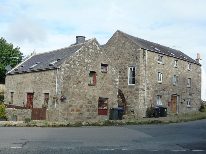
Early 19th century with later 3-storey 3-window granite
rubble frontage to street. 2 kilns, southern taller, pinned
Whinstone with brick kiln. 14' x 4' overshot all-iron wheel
with concrete lade between main building and tower S. block;
wheel appears to have been moved eastward. Disused.
Stuartfield is described as having been founded within the
last 25 years (ie 1770/95) by Mr Burnett or Dens in the OSA.
Laid out on across plan with a square at the intersection. Most
of the houses are original but have been altered.


Other nearby listed buildings