Approximate Location Map
Large Map »
Latitude: 51.824 / 51°49'26"N
Longitude: -3.0243 / 3°1'27"W
OS Eastings: 329503
OS Northings: 214428
OS Grid: SO295144
Mapcode National: GBR F5.W8GQ
Mapcode Global: VH796.JFK2
Plus Code: 9C3RRXFG+J7
Entry Name: House, including attached railings and gates
Listing Date: 8 February 1974
Last Amended: 10 November 2005
Grade: II
Source: Cadw
Source ID: 2438
Building Class: Domestic
ID on this website: 300002438
Location: On the street line at the far end of a group running SW from the junction with Brecon Road.
County: Monmouthshire
Town: Abergavenny
Community: Abergavenny (Y Fenni)
Community: Abergavenny
Built-Up Area: Abergavenny
Traditional County: Monmouthshire
Tagged with: House
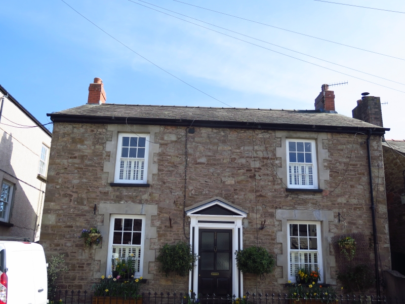
Early to mid C19 detached house, probably 1840s; shown on the town plan of Abergavenny of 1853. The roof material and the pebbledash walling have been removed since listing in 1974. It is shown on the 1844 Tithe Map.
Built of local random rubble sandstone with a natural slate roof and red brick stacks. Raised rusticated stucco window dressings indicate that the house was intended for render. Detached double depth central entry house with front elevation of two storeys, three bays. Two steps lead up to pedimented doorcase with panelled pilasters, plain reveals and 6-panelled door with top four panels glazed. Sash windows with 6 over 6 panes in plain reveals and rusticated surrounds. Plain low pitch roof with gable stacks
Shallow forecourt enclosed at each end by short stretch of walling and, in front by low C19 wrought iron railings and gates.
Rear elevation not inspected.
Interior not inspected at resurvey.
Included for its special interest as part of a well-preserved group of small scale early C19 housing close to the junction with Brecon Road.
External links are from the relevant listing authority and, where applicable, Wikidata. Wikidata IDs may be related buildings as well as this specific building. If you want to add or update a link, you will need to do so by editing the Wikidata entry.


Other nearby listed buildings
