Approximate Location Map
Large Map »
Latitude: 53.2526 / 53°15'9"N
Longitude: -3.9732 / 3°58'23"W
OS Eastings: 268452
OS Northings: 374662
OS Grid: SH684746
Mapcode National: GBR 0ZPT.MR
Mapcode Global: WH543.YH5T
Plus Code: 9C5R723G+2P
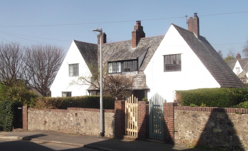
Entry Name: Bryn Haul
Listing Date: 14 April 1992
Last Amended: 14 April 1992
Grade: II
Source: Cadw
Source ID: 3522
Building Class: Domestic
ID on this website: 300003522
Location: Set back from road to L of Horeb Presbyterian Chapel.
County: Conwy
Community: Llanfairfechan
Community: Llanfairfechan
Built-Up Area: Llanfairfechan
Traditional County: Caernarfonshire
Tagged with: Building
By H L North, outstanding Arts and Crafts architect of his age in Wales, circa 1923, and although backing on to The Close not conceived as part of main scheme.
External links are from the relevant listing authority and, where applicable, Wikidata. Wikidata IDs may be related buildings as well as this specific building. If you want to add or update a link, you will need to do so by editing the Wikidata entry.


Other nearby listed buildings
