Approximate Location Map
Large Map »
Latitude: 53.2248 / 53°13'29"N
Longitude: -4.1431 / 4°8'35"W
OS Eastings: 257023
OS Northings: 371891
OS Grid: SH570718
Mapcode National: GBR 5P.0VD0
Mapcode Global: WH547.B6BN
Plus Code: 9C5Q6VF4+WP
Entry Name: Ffriddoedd Farmhouse
Listing Date: 2 August 1988
Last Amended: 2 August 1988
Grade: II
Source: Cadw
Source ID: 3982
Building Class: Domestic
ID on this website: 300003982
Location: Immediately to NE of Neuadd Reichel, reached up a sort drive. Slate paved forecourt.
County: Gwynedd
Community: Bangor
Community: Bangor
Built-Up Area: Bangor
Traditional County: Caernarfonshire
Tagged with: Building
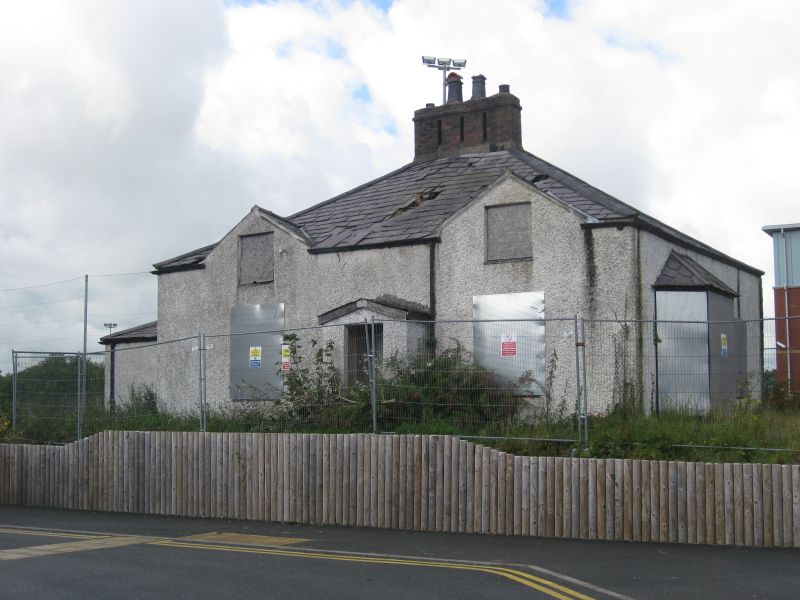
Early C19 vernacular single storey and attic farmhouse with pebbledash elevations. Slate roof, hipped and tall with 4 grouped chimney stacks to apex. Gabled attics to front, that to right has sliding small pane sash window and that to left has small pane casement. 16-pane sashes below flanking pitched roof porch with square headed entrance and recessed modern door.
Right hand side has Victorian splayed bay window with small pane casement windows and fishscale tiled roof; 12-pane sash beyond. Gabled attics to rear with casement windows and central gabled stairwell projection. Low hipped roof extension set back at left side with casement windows and boarded doors, double to rear.
The interior retains steep and narrow staircase, boarded doors and Regency chimney piece to ground floor. Now used as student accommodation.
External links are from the relevant listing authority and, where applicable, Wikidata. Wikidata IDs may be related buildings as well as this specific building. If you want to add or update a link, you will need to do so by editing the Wikidata entry.


Other nearby listed buildings
