Approximate Location Map
Large Map »
Latitude: 52.8536 / 52°51'12"N
Longitude: -3.6645 / 3°39'52"W
OS Eastings: 288013
OS Northings: 329754
OS Grid: SH880297
Mapcode National: GBR 69.SBBB
Mapcode Global: WH67B.PJ6Q
Plus Code: 9C4RV83P+C5
Entry Name: Pont-y-Pandy
Listing Date: 20 October 1966
Last Amended: 31 January 2001
Grade: II
Source: Cadw
Source ID: 4681
Building Class: Transport
ID on this website: 300004681
Location: Spanning the Afon Twrch at the SE end of the village.
County: Gwynedd
Community: Llanuwchllyn
Community: Llanuwchllyn
Traditional County: Merionethshire
Tagged with: Bridge Architectural structure
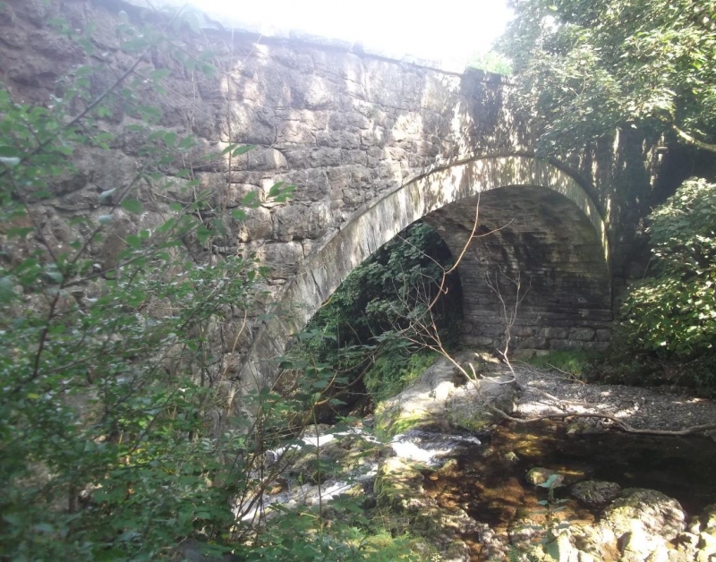
C18 or early C19 bridge of local type.
Large single-span road bridge of local stone construction. Segmental arch with rough-dressed voussoirs recessed below archrings of narrow stones in the regional manner. Plain parapets with slab-copings.
Listed as a good late C18 or early C19 regional road bridge retaining unaltered character.
External links are from the relevant listing authority and, where applicable, Wikidata. Wikidata IDs may be related buildings as well as this specific building. If you want to add or update a link, you will need to do so by editing the Wikidata entry.


Other nearby listed buildings
